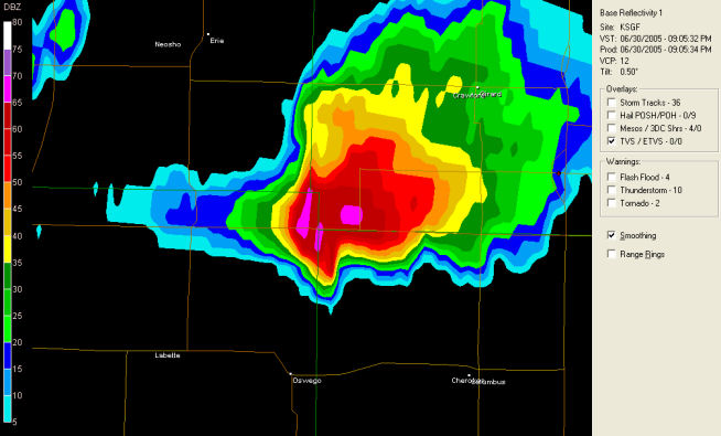
Hook Echo
At 8:35:35 PM
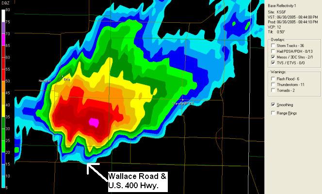
Hook Echo
At 8:44:08 PM
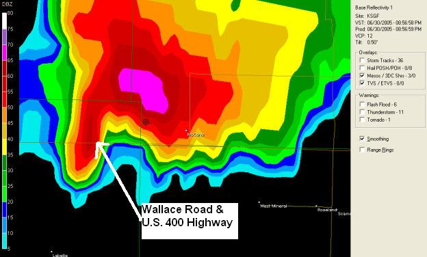
Hook Echo
At 8:56:58 PM
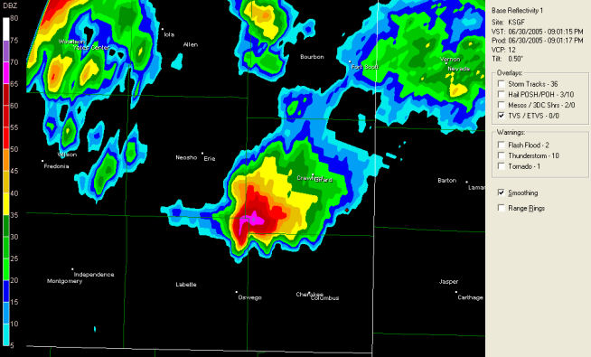
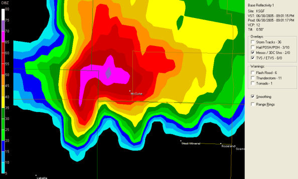
Wider Area Shot
At 9:01:15 PM
Hook Echo Over Hwy 400
At 9:01:15 PM
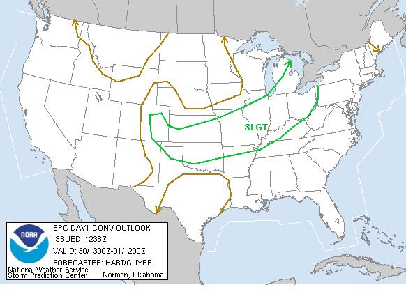
SPC Convective Outlook
At 7:38 AM CDT On June 30, 2005
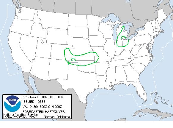
SPC Tornado Outlook
At 7:38 AM CDT On June 30, 2005
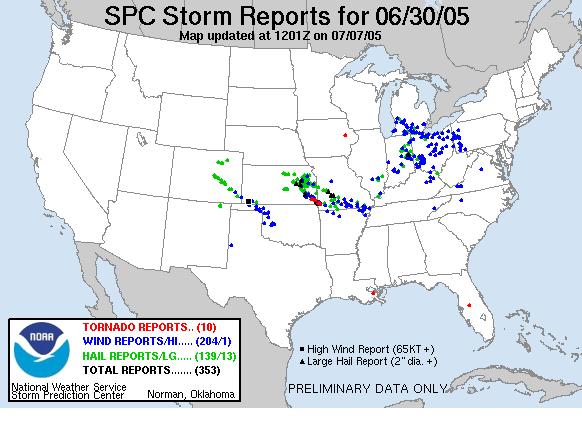
SPC Storm Reports For 06/30/2005
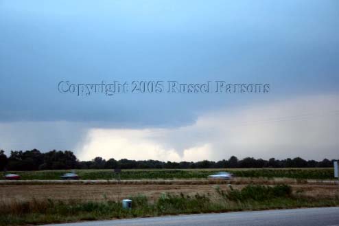
"Funnel Cloud"
Looking Northwest From Wallace Road and U.S. 400 Highway In Labette County, Kansas
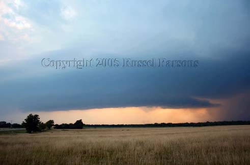
"Funnel Cloud"
Looking West From South 30th Street and U.S. 400 Highway In Crawford County, Kansas
To View The Entire Photo Album Of This Event, Please Click On Either Photograph Above
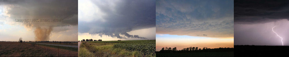
PHOTO GALLERY
NEXRAD WEATHER RADAR IMAGES
STORM PREDICTION CENTER CONVECTIVE OUTLOOK FOR THIS DAY
STORM REPORTS FOR THIS EVENT
NEWSPAPER ARTICLES AND OTHER STORM CHASER ACCOUNTS
Newspaper Articles For June 30, 2005
Other Storm Chaser Accounts For June 30, 2005
A Pleasant Surprise!!
June 30, 2005
NWS Damage Surveys & Other Reports
Chase Target:
Strauss, Kansas
Tornadoes:
00
02
Funnel Clouds:
Wall Clouds:
01
No
No
Flooding:
Hail:
Storm Intercept Summary
After monitoring a persistent supercell thunderstorm in Greenwood and Woodson County, Kansas on weather radar, I determined that the supercell would not die anytime soon.
I came up with a target area to the west of Strauss, Kansas or about eight miles east of Parsons, Kansas along U.S. 400 Highway. While sitting at that location, I witnessed a well defined wallcloud along with a short lived funnel cloud. The funnel cloud could have been a tornado, but I was too far away to see any debris cloud on the ground.
Later I witnesssed an unconfirmed tornado, while I was stationary along U.S. 400 Highway and South 30th Street in Crawford County, Kansas. This possible tornado would have been located in the Strauss, Kansas area. I continued to stay to the east of the eastbound wall cloud, and I watched it until it became to dark to see it anymore. Please view my weather blog at the link to your left for further details.