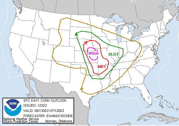
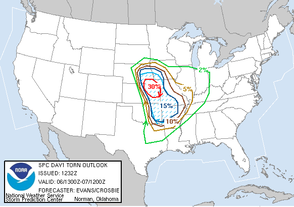
SPC Convective Outlook
At 7:32 AM CDT On
April 06, 2006
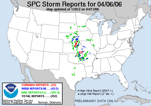
SPC Tornado Outlook
At 7:32 AM CDT On
April 06, 2006
SPC Storm Reports For April 06, 2006
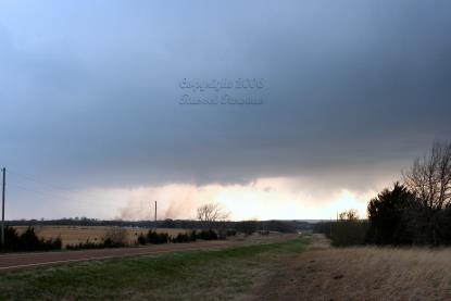
Looking West At A Forming Wall Cloud Just South Of Caney, Kansas
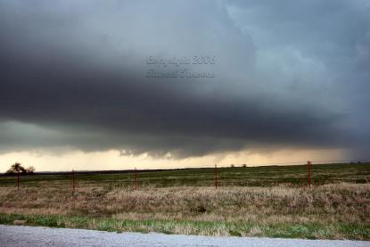
Looking North At A Wall Cloud Near South Mound, Kansas
This will be updated soon!!
For April 06, 2006
You can read my post about this incident on the Stormtrack Forums
Scroll down to my post or enjoy some of the other chaser's posts and photos.
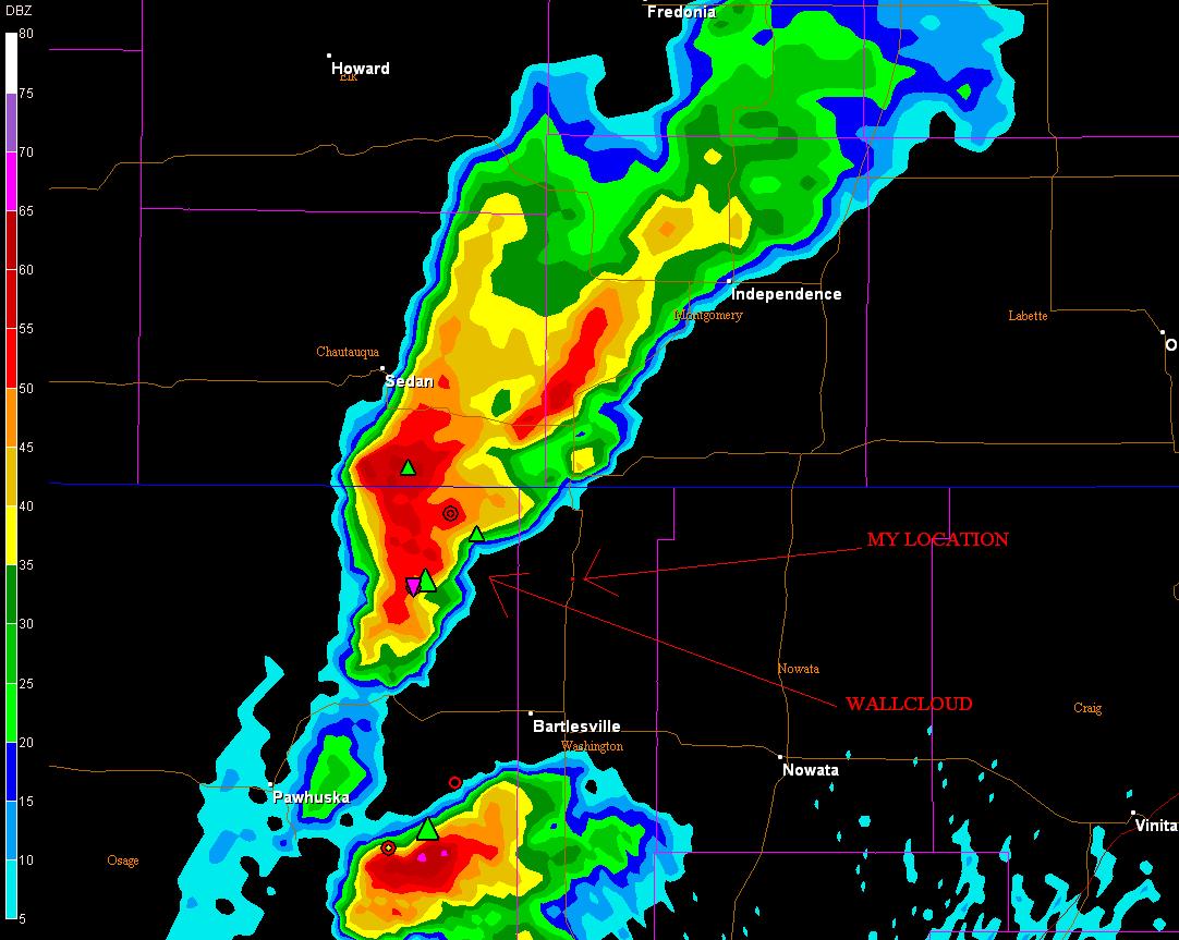
Tulsa NWS Nexrad Radar 5:13 P.M.
Base Reflectivity Image (Click To Enlarge)
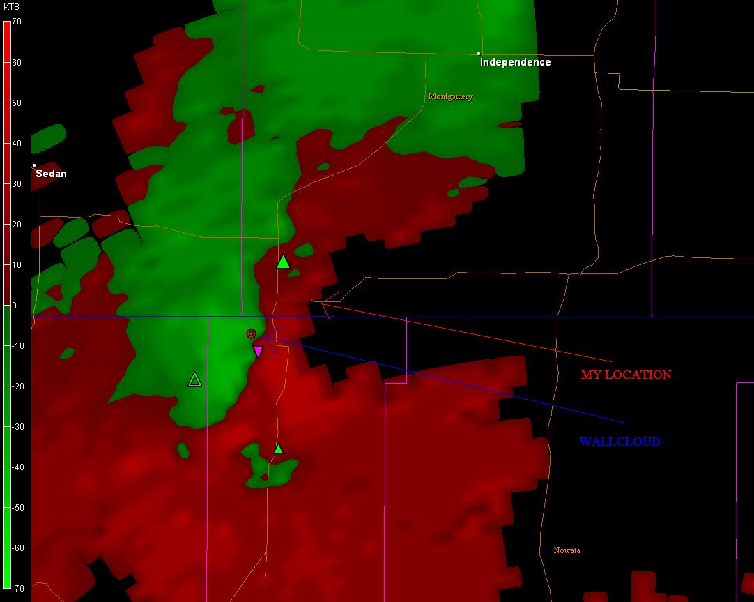
Tulsa NWS Nexrad Radar 5:30 P.M.
Velocity Image (Click To Enlarge)
To View The Entire Photo Album Of This Event, Please Click Here
Chase Target:
Independence, Kansas
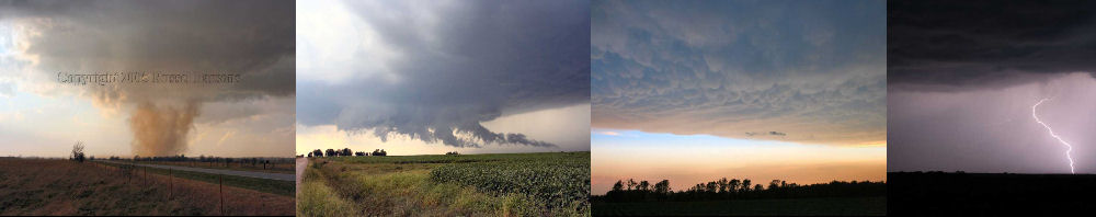
PHOTO GALLERY
NEXRAD WEATHER RADAR IMAGES
STORM PREDICTION CENTER CONVECTIVE OUTLOOK FOR THIS DAY
STORM REPORTS FOR THIS EVENT
NEWSPAPER ARTICLES AND OTHER STORM CHASER ACCOUNTS
Newspaper Articles For April 06, 2006
Other Storm Chaser Accounts For April 06, 2006
Storm Intercept Summary
Today was quite the day. I headed west out of Pittsburg, Kansas in the early afternoon. I proceeded to the area around Thayer, Kansas, where I checked data. After checking data I decided to move south to near Independence, Kansas, as prospects were better for tornadoes to form in north central Oklahoma. A fast moving supercell had formed in northeast Oklahoma, located to the southwest of Bartlesville. I proceeded to make my way to the southeast of Independence, Kansas, in order to stay out of the direct path of the supercell. I intercepted this supercell for the first time a couple miles northeast of Bartlesville, Oklahoma, and then paralled it for a bit until I got to the town of Caney, Kansas, located on the Kansas/Oklahoma border. A small, not well-defined wall cloud formed with this storm to the east of Caney, Kansas. The supercell kept up it's fast movement of approximately 45-50 MPH. The supercell went through some cycling, and the road network was not great in that part of Kansas. I intercepted the storm again north of Parsons, Kansas, where I saw another well-defined wall cloud near South Mound, Kansas. I did not see any tornadoes today, but the chase was well worth it!!
Tri-State Storm Chase
April 06, 2006
Tornadoes:
Funnel Clouds:
Wall Clouds:
Hail:
Flooding:
No
No
03
00
00