Other Storm Chaser Accounts For May 25, 2006
Chase Target:
Pittsburg, Kansas
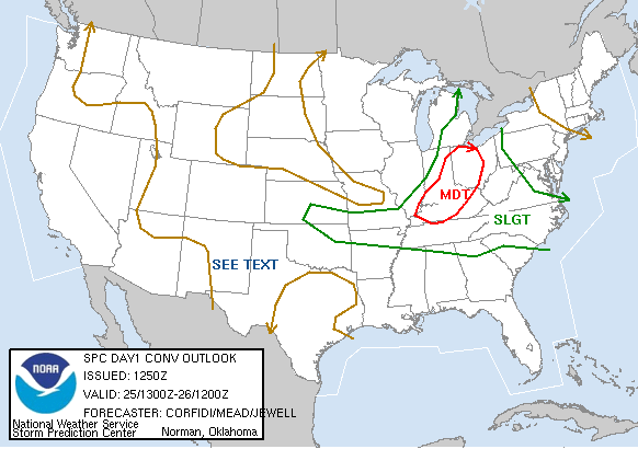
SPC Convective Outlook
At 7:50 AM CDT On
May 25, 2006
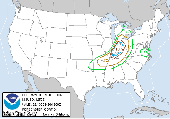
SPC Tornado Outlook
At 7:50 AM CDT On
May 25, 2006
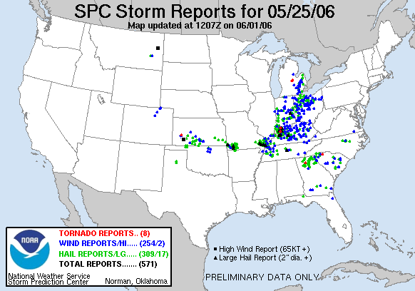
SPC Storm Reports For May 25, 2006
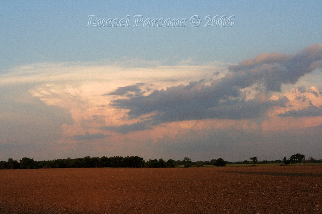
Looking Southeast At A Supercell Thunderstorm From Western Jasper County
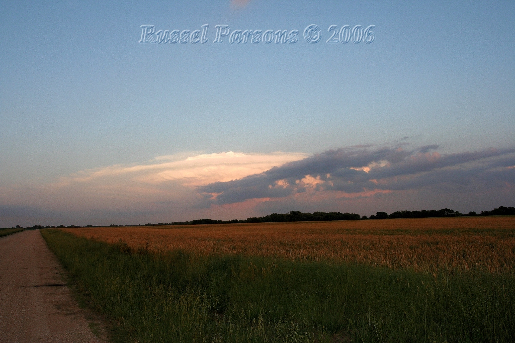
Looking Southeast At A Supercell From Just North Of Asbury, Missouri
[Pittsburg, Kansas] Morning Sun "" 00-00-2006
No National Weather Service Damage Assessment Was Found For May 25, 2006
No Storm Chaser Accounts For This Day Could Be Located
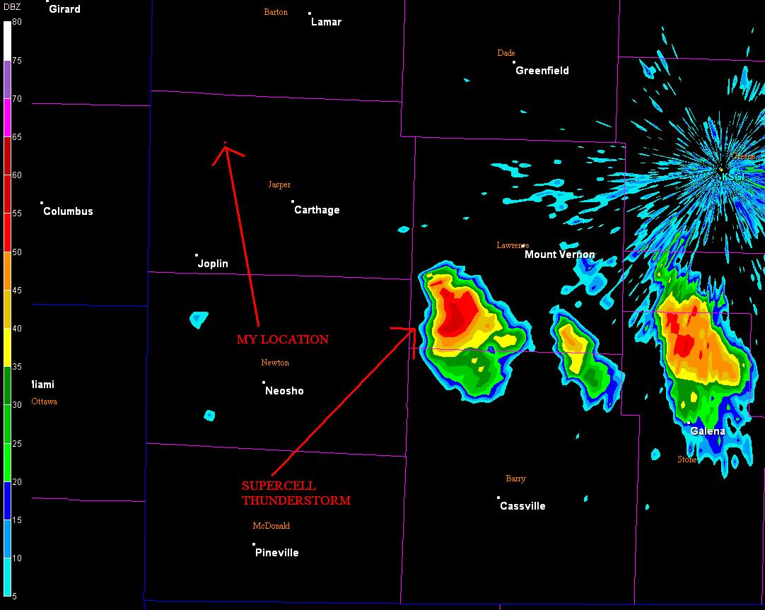
Springfield NWS Nexrad Radar 5:42 P.M.
Base Reflectivity Image (Click To Enlarge)
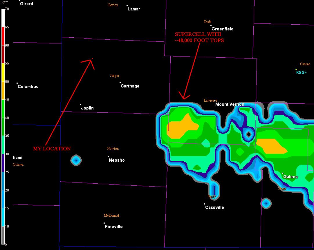
Springfield NWS Nexrad Radar 5:42 P.M.
Echo Tops Image (Click To Enlarge)
To View The Entire Photo Album Of This Event, Please Click Here
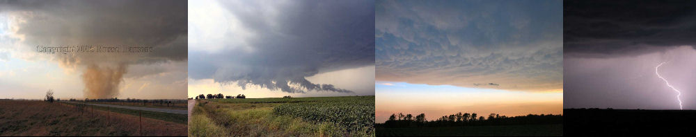
PHOTO GALLERY
NEXRAD WEATHER RADAR IMAGES
STORM PREDICTION CENTER CONVECTIVE OUTLOOK FOR THIS DAY
STORM REPORTS FOR THIS EVENT
NEWSPAPER ARTICLES AND OTHER STORM CHASER ACCOUNTS
Newspaper Articles For May 25, 2006
Storm Intercept Summary
I'll start by giving a definition of a supercell thunderstorm. "A supercell is a severe thunderstorm with a deep rotating updraft. Supercell thunderstorms are the largest, most severe class of single-cell thunderstorms." This particular chase was great for snapping some photographs of a supercell thunderstorm that was many miles from by location. I drove around Jasper County, Missouri, as this supercell moved ever so slowly to the East-Southeast. As I took most of my photographs of this supercell thunderstorm, the storm was about thirty-five miles to my Southeast or near Pierce City, Missouri.
I ended up driving to the east of Webb City, Missouri and then back towards Asbury, Missouri towards sunset. The supercell was most photogenic towards sunset, with a very pronounced over-shooting top. The over-shooting top is evidence to how strong the updraft of this supercell must have been. The stronger the updraft, the stronger and more severe the thunderstorm. This thunderstorm dropped some one to two inch hail in Lawrence and Stone Counties, in Southwest Missouri.
Additional Photos From The Springfield NWS Office Can Be Found Here
Southwest Missouri Supercell
May 25, 2006
Tornadoes:
Funnel Clouds:
Wall Clouds:
Hail:
Flooding:
No
No
00
00
00