Other Storm Chaser Accounts For May 07, 2008
Chase Target:
Durant, Oklahoma
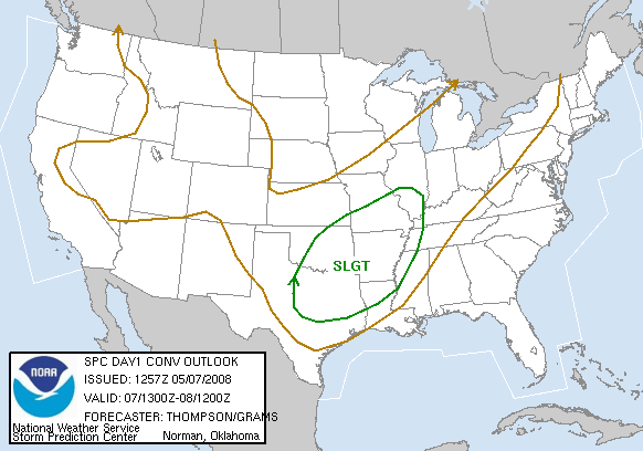
SPC Convective Outlook
At 7:57 AM CDT On
May 07, 2008
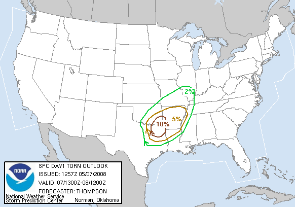
SPC Tornado Outlook
At 7:57 AM CDT On
May 07, 2008
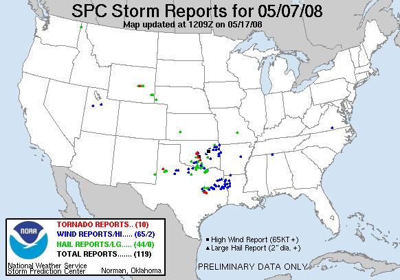
SPC Storm Reports For May 07, 2008
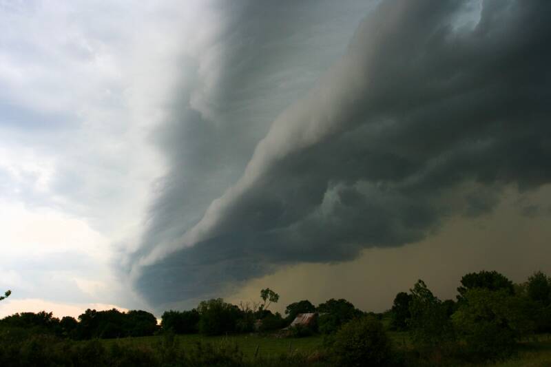
Non-Rotating Wall Cloud East Of Marietta, Oklahoma
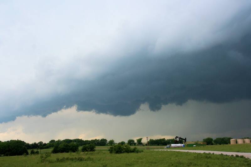
Shelf Cloud Approximately 8 Miles South Of Bennington, Oklahoma
No articles have been located about this event!!
Check Other Storm Chaser's Accounts For This Day At The Stormtrack Forums
These will be added when time permits...
To View The Entire Photo Album Of This Event, Please Click Here (Clicking The Slideshow Is The Best Option)
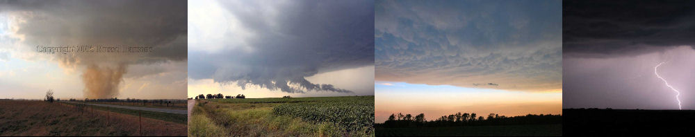
PHOTO GALLERY
NEXRAD WEATHER RADAR IMAGES
STORM PREDICTION CENTER CONVECTIVE OUTLOOK FOR THIS DAY
STORM REPORTS FOR THIS EVENT
NEWSPAPER ARTICLES AND OTHER STORM CHASER ACCOUNTS
Newspaper Articles For May 07, 2008
Storm Intercept Summary
Wow, my second chase in Southeast Oklahoma didn't give me any tornadoes to photograph, but it did give me a good dose of photogenic shelf clouds. I ended up chasing in the Red River valley, which proved to be very challenging.
I did get to see a short-lived wall cloud near Marietta, Oklahoma, before the storm became outflow dominate. I stayed to the east of this monster storm, and I was treated to an awesome shelf cloud as the storm passed over Lake Texoma.
The storm continued producing a great looking shelf cloud, and the ultimate catch was south of Bennington, Oklahoma, just a few miles north of the Red River. This particular shelf cloud was the most menacing looking storm structure that I have seen for several years.
I once again have made a note to myself to stay away from the Southeast Oklahoma area for future storm chasing. The terrain and road network are both very unfriendly to chasing storms.
SE Oklahoma & NE Texas
May 07, 2008
Tornadoes:
Funnel Clouds:
Wall Clouds:
Hail:
Flooding:
00
00
01
No
No