Other Storm Chaser Accounts For February 10, 2009
Storm Chasing Blog
Chase Target:
Independence, Kansas
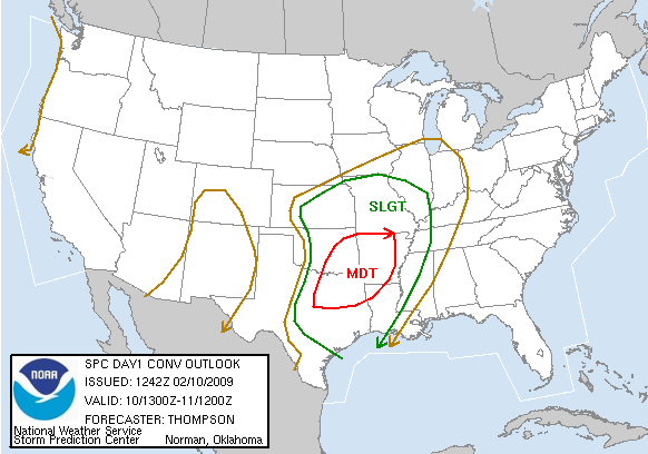
SPC Convective Outlook
At 6:42 AM CDT On
February 10, 2009
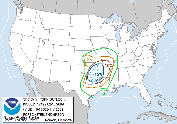
SPC Tornado Outlook
At 6:42 AM CDT On
February 10, 2009
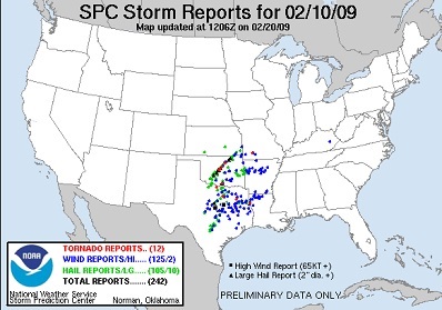
SPC Storm Reports For February 10, 2009
No Photographs Were Taken Of This Event, Since It Occurred Mostly After Dark!
No articles have been located about this event!!
No Chaser Accounts Were Found For This Day
To View The Entire Photo Album Of This Event, Please Click Here (Clicking The Slideshow Is The Best Option)
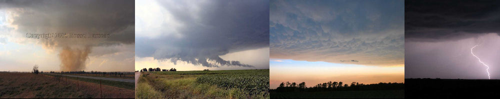
PHOTO GALLERY
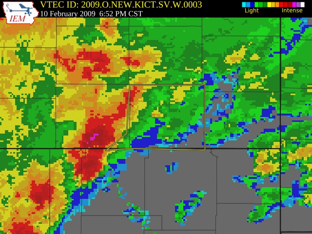
NEXRAD WEATHER RADAR IMAGES
STORM PREDICTION CENTER CONVECTIVE OUTLOOK FOR THIS DAY
STORM REPORTS FOR THIS EVENT
NEWSPAPER ARTICLES AND OTHER STORM CHASER ACCOUNTS
Newspaper Articles For February 10, 2009
Storm Intercept Summary
This was an early severe weather event, with it taking place in early February. The day started with Southeastern Kansas being placed in a Slight Risk of severe thunderstorms. I decided not to chase the moderate risk of severe thunderstorms in Oklahoma today, so I stayed in Kansas to play the part of local storm spotter. I made contact with the first storm of the day to the West of Mound Valley, Kansas, which is located in Southern Labette County Kansas. The severe thunderstorm contained at least 65 MPH winds. It was really hard to estimate wind speeds with this storm, since there were no leaves on the trees. Afterall, it was happening in Feburary. I did contact the National Weather Service in Wichita, Kansas to report this severe thunderstorm. This particular severe thunderstorm continued to cause wind damage across Cherokee County Kansas and Jasper County Missouri.
Mound Valley, Kansas Wind
February 10, 2009
Tornadoes:
Funnel Clouds:
Wall Clouds:
Hail:
Flooding:
00
00
00
None
No